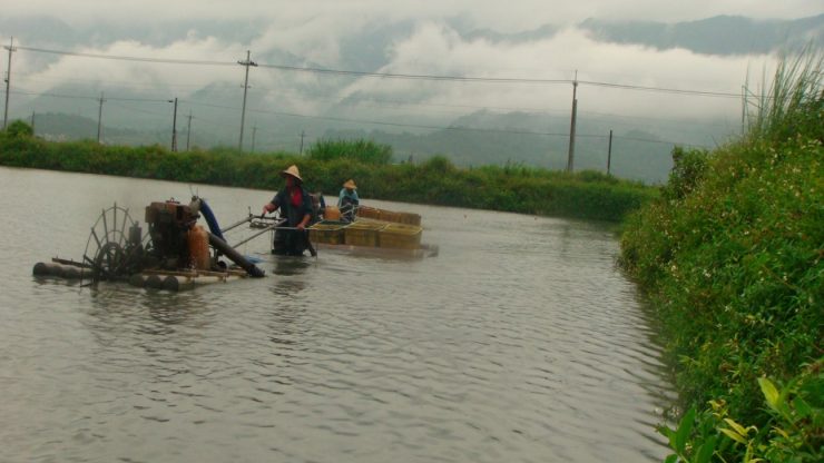
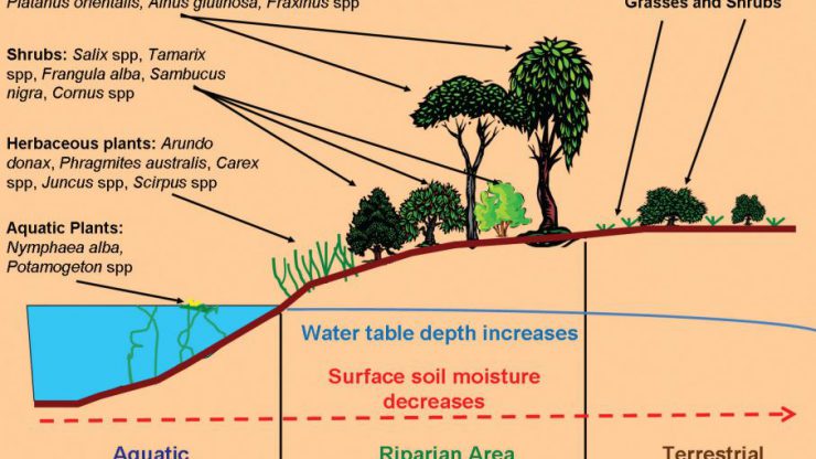
GIS and its applications and help resolve many environmental problems including water resources management. In today world of technology knowing how to utilize GIS is a necessity for all water managers. This powerful set of tools can be used to in hydrological modeling, environment and habitat assessments, ecosystem-based studies, monitoring of riparian, wetlands and forested ecosystems, urban studies, and agricultural impact assessment. This course will explain to student the fundamentals of GIS, demonstrates techniques and methods for sustainable water management, and provides examples of real applications. It will present how to acquire the critical information needed to plan and implement water resources management plans, and develop practical solutions for water management problems.
GIS for Water Management


01-10-2020
6 Months
per person /
$
550
GIS for Water Management
Teacher
Xofis Pantelis
Category
Core
Course Attendees
Still no participant
Course Reviews
Still no reviews
Aim
Learning Objectives
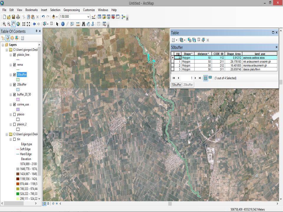
- Introduction to geographic information systems and remote sensing technologies
- Learn how to digitize, map projections and coordinate systems
- Create digital elevation models, and mapping of water and environmental features
- Delineate watersheds, streams and aquifers delineation
- Soil and land use mapping
- Map algebra
- Terrain analysis for hydrological modelling
Learning Goals
On completion of this module, students are expected to be able to:
- Knowledge of the ArcHydro applications
- Development spatial datasets at the watershed scale relevant to water resources management
- Present water resources data as map and electronic forms easy-to-understand for water organization and agencies
- Utilize GIS-based analytical and problem-solving techniques for sustainable planning and management of water resources and environmental problems
ECTS
6 credits
Bibliography
- Lyon, J.G. GIS for Water Resource and Watershed Management. CRC Press, pp. 274. (2002)
- Maidment, D.R. (ed.) Arc Hydro: GIS for Water Resources. Environmental Systems Research Institute Inc., pp. 224. (2002)
Our Main Teachers

Price : 550 $ |
|
Max Availability : 40 |
|
Difficulty : Semester Α’ |
|
Typology : Core |
Question
Related Products